7 Best GPX Viewers for iPhone in 2026 (Free & Paid)


On this page
A GPX file reaches an iPhone through AirDrop, Mail, a download in Safari, or an export from a watch app, and it ends up in the Files app. From there it needs an app that can draw it. Which app is right comes down to one thing: are you checking the file at home, or carrying it onto a trail with no signal?
For checking a file, GPXExplore is the best GPX viewer for iPhone. It opens any GPX for free and shows the elevation profile, climbs and sensor data without an account. For the trail, a map app with downloaded maps is the safer pick, and Organic Maps does that with no paid tier at all.
The apps below fall into those two groups, plus one option that needs no install at all.
How a GPX File Gets Into an iPhone App
Most of these apps accept a file in one of two ways. You either open the app and pick the file through its own import screen, or you start in Files, tap the share button and send the file to the app. Guru Maps documents the second route in its import manual: find the file in Files, tap share, then choose the app.
Not every viewer supports both routes, and the difference is noted in each section where the developer states it. Before you buy anything, it is worth trying the import with a file you already have. If you don't have one handy, the sample GPX files on this site include tracks, routes and waypoints.
1. GPXExplore - Best Overall GPX Viewer for iPhone
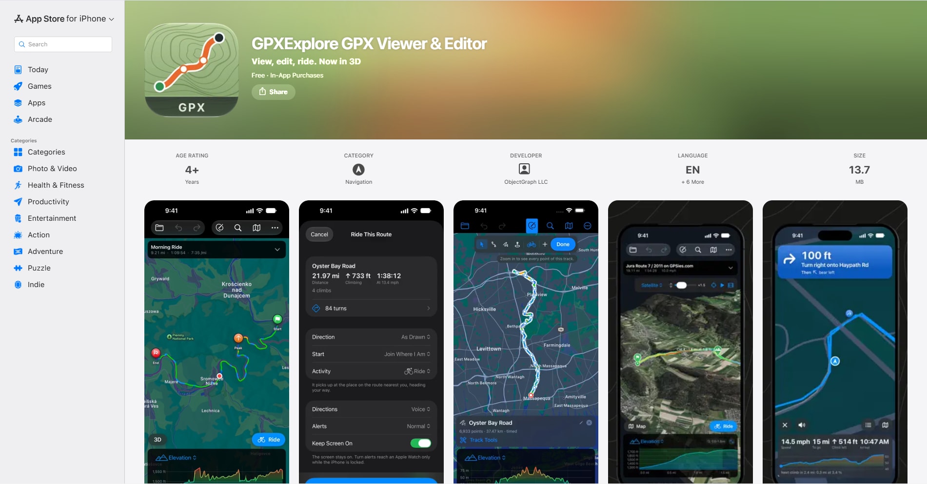
GPXExplore takes first place because everything a viewer needs is in the free part. The developer's product page says viewing any GPX file is free, along with climb detection, printing and recording on iPhone.
The elevation chart is the reason to pick it over a plain map viewer. You can scrub along it and switch the chart between elevation, heart rate, cadence, power, speed and temperature when the file contains them. Climbs are detected and graded from Category 4 up to HC, with length and average grade for each. It reads GPX 1.0 and 1.1 files with tracks, routes and waypoints.
Two limits matter. The app needs iOS 17.6 or later, so older iPhones are out. And the map is Apple Maps: the product page describes 3D terrain staying on the device after the first view, but it doesn't promise general offline maps. Treat it as the app for looking at a file, not for navigating without signal.
Editing, 3D flyovers and turn-by-turn riding sit in GPX Explore Pro, listed on the App Store as a $9.99 in-app purchase. The developer describes it as a one-time purchase that also covers iPad and Mac.
What works well:
- Free viewing with an elevation profile, climbs and per-mile or per-kilometer splits
- Charts for heart rate, cadence, power and temperature when the file has them
- No account and no ads, with an App Store privacy label of "Data Not Collected"
Where it falls short:
- Requires iOS 17.6 or later
- No documented offline map downloads
- Moving, cropping and joining points needs the Pro purchase
Elevation lookups send point coordinates to the developer's server, and the product page says that can be switched off. Pick Organic Maps instead when the phone will be offline.
2. Organic Maps - Best Free Offline GPX Viewer
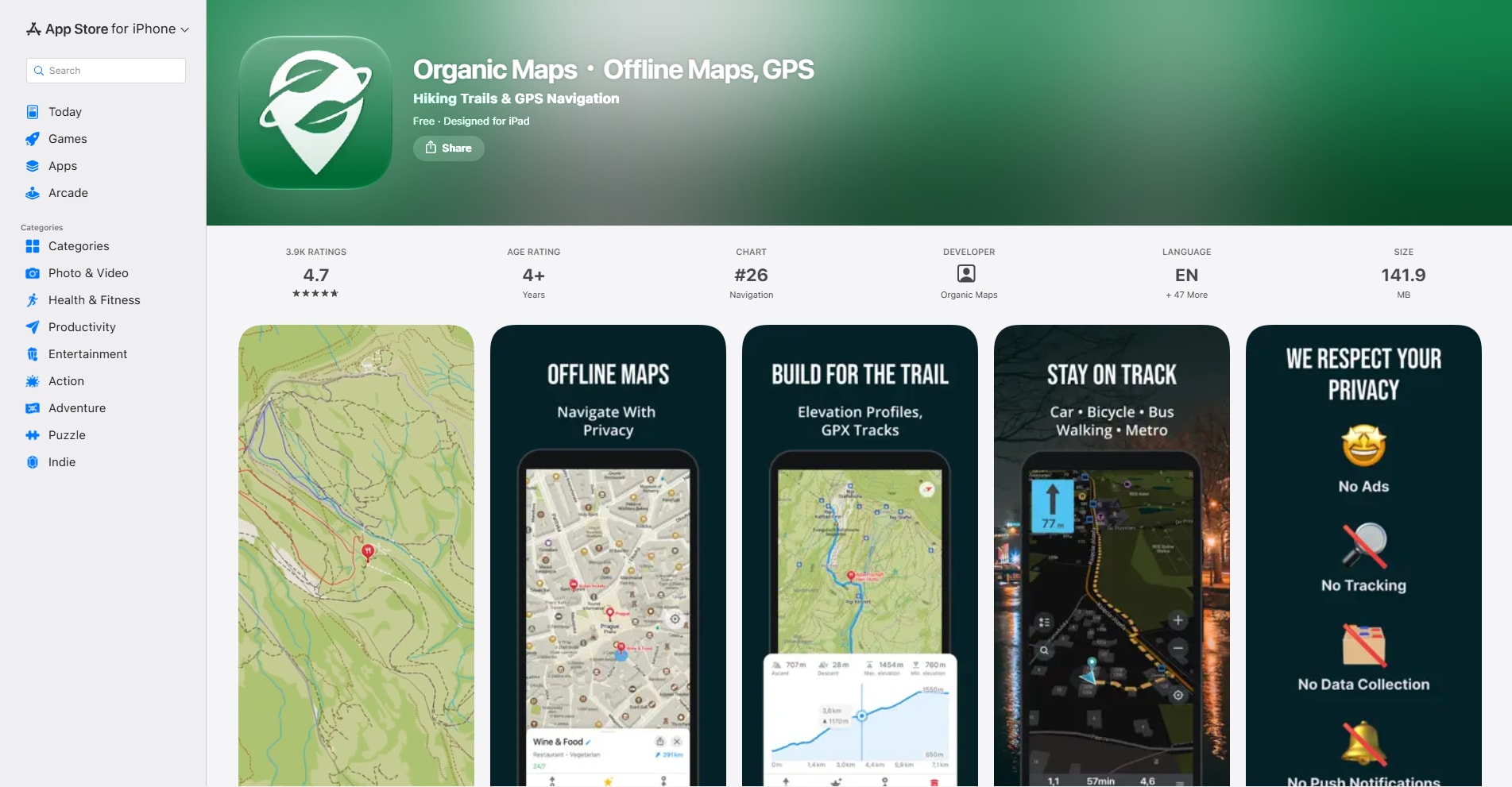
Organic Maps is a full offline map app that also opens GPX files, and it costs nothing. Its site lists import, export and sharing of tracks and bookmarks in GPX, KML, KMZ and GeoJSON, plus elevation profiles for tracks that carry altitude data.
What separates it from the other map apps here is the absence of a paid tier. The App Store listing shows no in-app purchases and a "Data Not Collected" privacy label, and the project states it has no ads and no tracking. The code is open source under the Apache 2.0 licence. You download a region once, then search, route and follow an imported track without a connection.
The trade-off is analysis. The site lists elevation profiles, but not speed charts or heart rate and power graphs, so a workout file shows less here than in GPXExplore.
What works well:
- Free, with no ads and no map download limit listed
- Offline maps with imported GPX, KML and KMZ tracks on top
- Runs on iOS 15 or later, so it suits older iPhones
Where it falls short:
- No sensor charts listed for heart rate, cadence or power
- It is a map app first, so file statistics are basic
Choose it for hiking or travel with a route someone sent you. Move to OsmAnd if you also want to analyse or change the track.
3. OsmAnd - Best for Analysing and Fixing a Track Offline
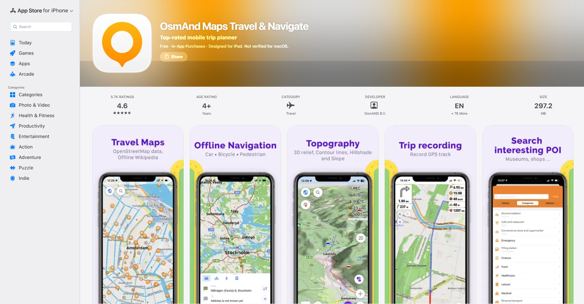
OsmAnd does the most with a GPX file among the offline map apps here. Tap a track, open the Track tab and choose Analyze on map. The track documentation says the graph can plot altitude, slope, speed and external sensor data against distance or time, and tapping the graph shows that point on the map.
It also goes furthest on editing. Menu > Plan a route > Open existing track lets you move, add and delete points, trim before or after a point, split, join segments and reverse the route, then save a copy. Two tools in the Plan a route guide are marked Android only: the GPS filter and the option to fetch elevation data.
The free version has a hard limit that affects trail use. OsmAnd's iOS purchases page caps the free app at five map downloads, and a map update counts as one. Maps+ removes most restrictions for $14.99 a year or $69.99 once.
What works well:
- Altitude, slope and speed graphs tied to the map
- Point editing, trimming, splitting, joining and reversing on the phone
- GPX import and export included in the free version
Where it falls short:
- Five map downloads on the free tier
- More menus and settings than a simple viewer needs
- GPS filter and elevation correction are not available on iOS
Pick OsmAnd when you'll use the extra tools. For a quick look at one file, the next app is far lighter.
4. GPX-Viewer - Best Simple Viewer for Older iPhones
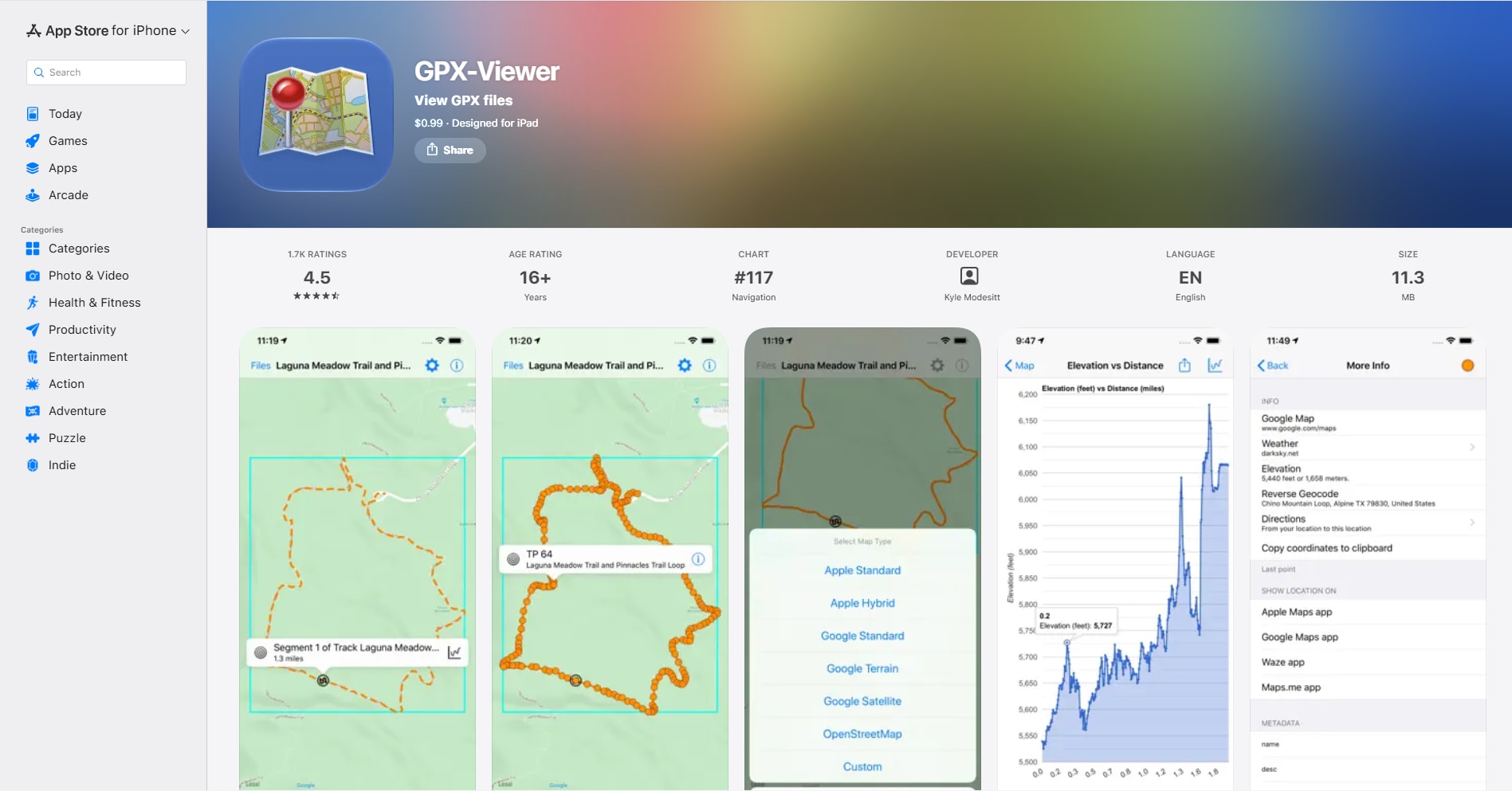
GPX-Viewer by Kyle Modesitt is a small paid app that does one job. It costs $0.99 with no in-app purchases listed, and it runs on iOS 12.4 or later, which covers phones the newer apps have dropped.
The listing describes loading files from iCloud, Dropbox, Google Drive, email, a URL or the clipboard. You can show or hide waypoints, tracks and routes, chart elevation or speed against distance or time, and open a statistics panel with track length and minimum and maximum speed and elevation. The base map can be Apple Maps, Google Maps, OpenStreetMap, OpenTopoMap or a custom tile URL, which is unusual at this price.
Its privacy label reads "Data Not Collected". The limits are about scope: the listing doesn't describe offline maps or exporting a GPX file, and the latest version shown is 3.8.90 from October 2025.
What works well:
- One small payment, no subscription and no account
- Several base maps, including a custom tile source
- Elevation and speed charts with basic statistics
Where it falls short:
- No offline maps or GPX export described
- No sensor charts for heart rate or power
- The latest update shown is from October 2025
It suits someone who opens a GPX file a few times a year and wants nothing else on the screen.
5. GPX Viewer PRO - Best for Heart Rate, Cadence and Power Data
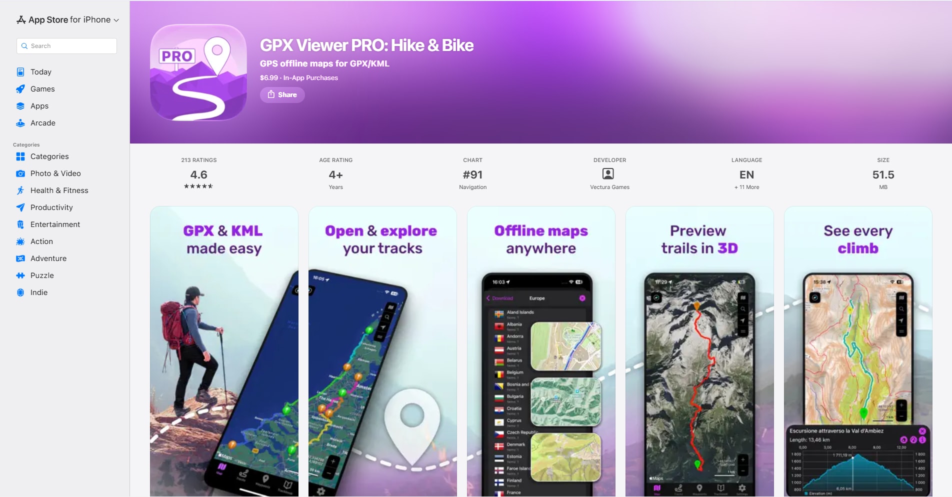
GPX Viewer PRO from Vectura Games is the paid choice when one app has to cover both the file and the trail. It costs $6.99 up front, opens GPX and KML, and shows several tracks, routes and waypoints at once with their own colours.
The listing mentions elevation and speed profiles, climbs, and support for heart rate, cadence and power, along with comparing activities over time. Offline maps can be downloaded worldwide, and tracks can be exported as GPX or KML. Routes planned on the developer's free Trackbook website sync to the phone.
Check three things before paying. It needs iOS 17.6 or later. The listing shows one in-app purchase, "Online services" at $1.99, without explaining what it adds. And the privacy label lists usage and diagnostic data collected for analytics, described as not linked to you.
What works well:
- GPX and KML in one viewer, with export to both
- Sensor data alongside elevation and speed
- Offline maps and live position on the same screen
Where it falls short:
- Paid up front, so you can't try the import first
- Requires iOS 17.6 or later
- Collects usage analytics, unlike GPXExplore, Organic Maps and GPX-Viewer
Choose it over GPXExplore if you need offline maps and sensor data together. If the files are TCX or KMZ, look at Guru Maps instead.
6. Guru Maps - Best for Mixed File Formats
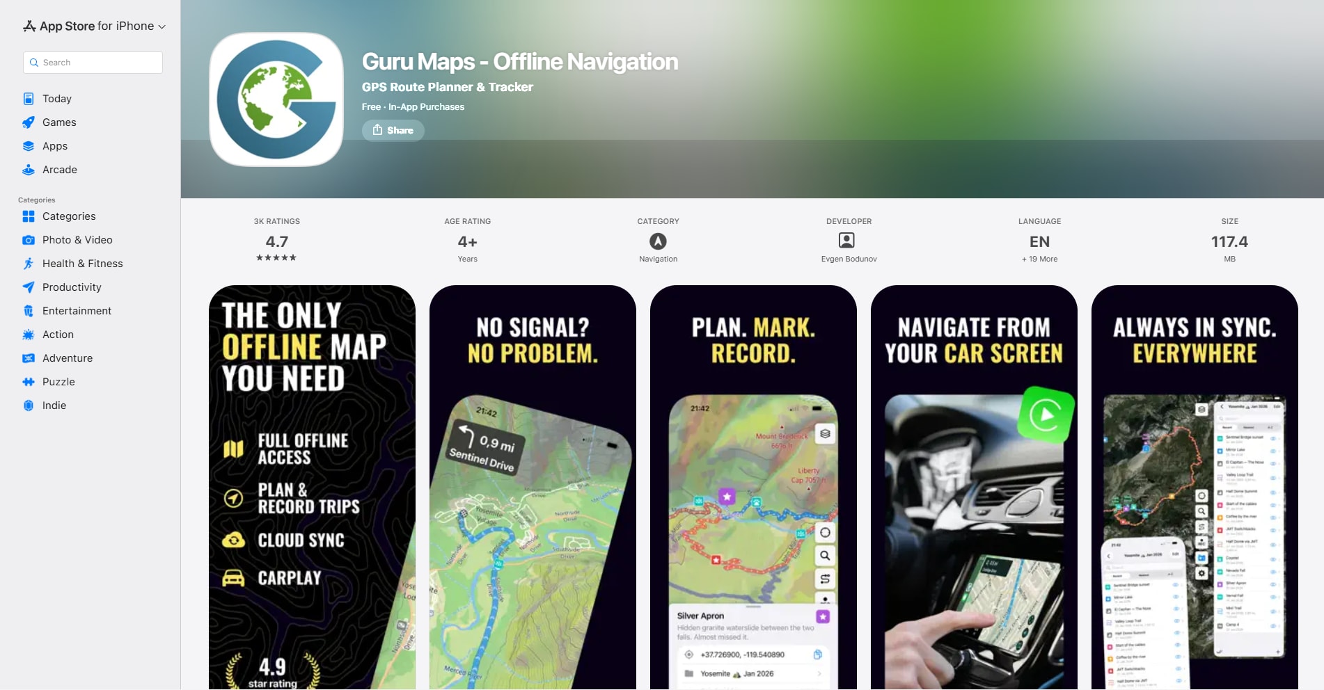
Guru Maps earns its place through import range. Its manual lists GPX, KML, KMZ, TCX, WPT, PLT and GeoJSON as import formats, with export to GPX, KML and GeoJSON. That helps when files come from different devices and friends.
Track details show distance, duration, climb and descent, and moving and idle time. The chart switches between altitude, speed and slope, and the track line can be coloured by speed or altitude. The tracks manual also describes Edit Track > Trim Track, and states that trimming can be undone later.
The cost is harder to judge. The App Store listing says Pro gives unlimited markers, GPS tracks and offline map downloads, but it doesn't state what the free limits are. Pro is $2.99 a month, $29.99 a year or $89.99 once. The privacy label lists purchase history and a device ID as linked to you for analytics.
What works well:
- Seven import formats, including TCX and KMZ
- Altitude, speed and slope charts with reversible trimming
- Offline maps, on iOS 15 or later
Where it falls short:
- Free limits on tracks, markers and maps are not published on the listing
- The lifetime price is the highest in this list
- Its privacy label lists more collected data than Organic Maps
7. gpx.studio - Best Without Installing an App
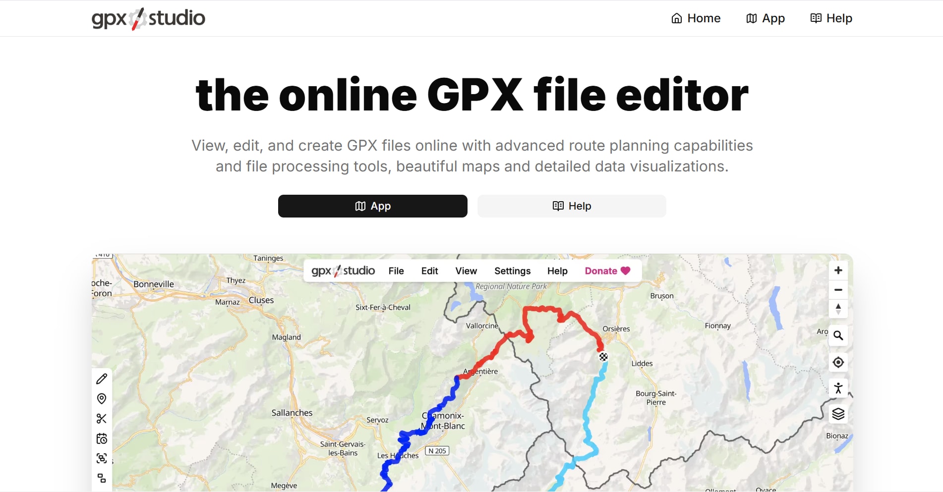
gpx.studio is a website, so it works for a one-off file on a phone you don't want to fill with apps. The site describes itself as free, ad-free and open source, and says GPX files never leave the browser.
For this article, a 60-point test track with elevation and timestamps was loaded into the app page in a browser window 375 pixels wide, the width of a small iPhone.
The file opened, the toolbar stayed on screen, and the panel under the map showed the distance, total ascent and an elevation profile. That check ran in a desktop browser at phone width, not in Safari on an iPhone, so touch behaviour is not covered by it.
It is an editor as much as a viewer, with tools to crop, split, reverse and re-route a track. On a small screen that is a lot of controls, and there are no offline maps because it runs in a browser tab.
What works well:
- Nothing to install and no account
- Files are processed in the browser
- Elevation profile and statistics appear as soon as the file loads
Where it falls short:
- Needs a connection for the map
- Dense controls on a phone screen
- No offline maps
iPhone GPX Viewer Comparison
Before You Rely on a GPX File Offline
A track that looks fine on Wi-Fi can be useless on the trail. Run through this once at home:
- Download the map region for the whole route, not only the start.
- Turn on Airplane Mode and open the track again. If the map behind it is blank, the download didn't cover it.
- Zoom in to the level you'll use while walking and check the detail is still there.
- Check that waypoints came through. A file can hold tracks, routes and waypoints, and a viewer may show only some of them.
- Keep the original file in Files or iCloud Drive, so you can import it into a second app if the first one fails.
If a trip is split across several files, join them first with the GPX merger so the phone has one track to load. The GPX merging guide explains what happens to segments and timestamps.
Which GPX Viewer Should You Pick?
- GPXExplore: you want to look at a file, its climbs and its sensor data, for free.
- Organic Maps: you want a free offline map with the track on top and no limits to manage.
- OsmAnd: you want graphs tied to the map and the option to fix the track on the phone.
- GPX-Viewer: your iPhone is older, or you want the smallest possible app.
- GPX Viewer PRO: you need offline maps and heart rate or power data in one paid app.
- Guru Maps: your files arrive as TCX, KMZ or GeoJSON as well as GPX.
- gpx.studio: you need to open one file now and install nothing.
Frequently Asked Questions
What is the best free GPX viewer for iPhone?
GPXExplore is the best free choice for inspecting a file, because viewing, the elevation profile and climb detection are all free. Organic Maps is the better free choice outdoors, since it adds offline maps with no paid tier.
Can I view a GPX file on iPhone without internet?
Yes, with an app that stores maps on the phone. Organic Maps, OsmAnd, GPX Viewer PRO and Guru Maps all offer offline map downloads. Download the region first and test it in Airplane Mode before you leave.
Can I edit a GPX file on an iPhone?
OsmAnd can move, add and delete points, trim, split, join and reverse a track through Plan a route. GPXExplore offers similar editing in its Pro purchase, and Guru Maps can trim a track. For larger repair jobs, a desktop editor is easier: see the guides for Mac and Windows.
Which iPhone GPX viewer shows heart rate and power?
GPXExplore charts heart rate, cadence, power and temperature when the file includes them. GPX Viewer PRO also lists heart rate, cadence and power support. Organic Maps and GPX-Viewer don't list sensor charts.
Related GPX Guides
Read More
All Articles
6 Best GPX Editors and Viewers for Android in 2026
Compare the best GPX editors and viewers for Android for repairing tracks, inspecting elevation and sensor data, using offline maps, and navigating routes.

7 Best GPX Editors and Viewers for Mac in 2026
Compare the best GPX editors and viewers for Mac for repairing track points, planning routes, viewing elevation, using offline maps, and managing Garmin devices.
7 Best GPX Editors and Viewers for Windows in 2026
Compare the best GPX editors and viewers for Windows 10 and 11 for editing track points, planning routes, viewing elevation, using offline maps, and managing Garmin devices.